


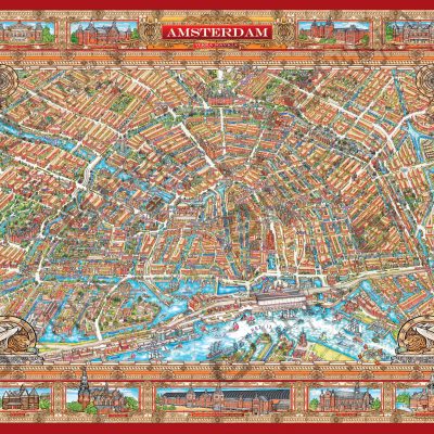
City Centre Amsterdam Map
- Offset print, Size 70x100cm, Full Colour with protective water based varnish.
- Printed one side.
- Paper weight 130 grams.
- Items weight 110 grams.
- Package weight of single item, 138 grams.
- Shipping costs include order handling and packaging costs.
€10,00 Including Tax 19% €11,90

Embark on a captivating visual journey through the heart of Amsterdam with our meticulously crafted illustrated City Centre Amsterdam Map, celebrated as the quintessential Amsterdam Attractions Map. Designed with the expertise reminiscent of the great cartographers of the golden era, this artistic masterpiece is the result of 16 months of dedicated creativity.
The map unfolds a unique and prospective view of 12 square kilometers within Amsterdam's historical city center, sprawled across a vast 4x3km canvas. Immerse yourself in the architectural splendor as 56 monuments and 31 museums, seamlessly integrated into the city attractions, come to life in exquisite detail.
Our comprehensive map is an invaluable resource for tourists, seamlessly guiding you through Amsterdam City Centre and its myriad cultural and historical treasures. Enrich your exploration with a detailed index, ensuring you won't miss a moment of discovery. From iconic city attractions to the enchanting center with museums, our map is your trusted companion.
Navigate effortlessly through the rich tapestry of experiences that Central Amsterdam offers, using the excellent network our map provides. For a seamless exploration of Amsterdam's attractions, particularly the centre with museums, our tourist maps offer an immersive experience that extends beyond the ordinary, making your visit truly extraordinary.
Related products
-
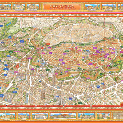
Nicosia Map
€10,00 Including Tax 19% €11,90 Add to cart -
Sale!
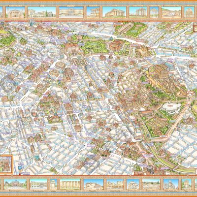
Illustrated Panoramic Athens Map - BOX 50 pcs
Original price was: €500,00.€200,00Current price is: €200,00. Including Tax 19% €238,00 Add to cart -
Sale!
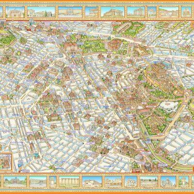
Illustrated Panoramic Amsterdam Map - BOX 50pcs
Original price was: €500,00.€200,00Current price is: €200,00. Including Tax 19% €238,00 Add to cart -
Athens Map
€10,00 Including Tax 19% €11,90 Add to cart

