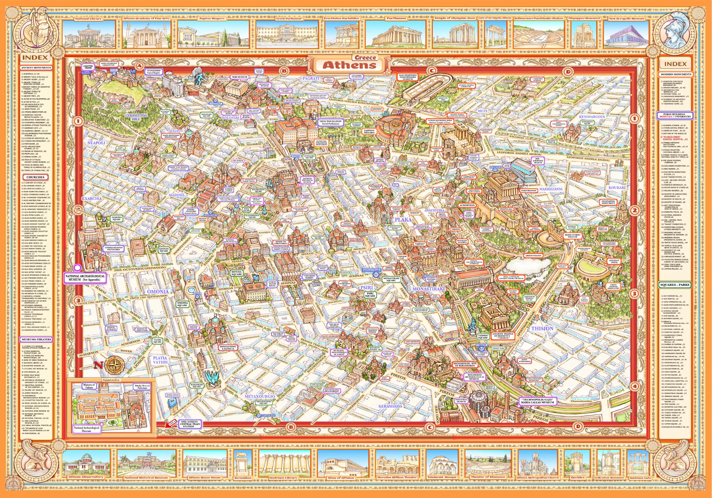
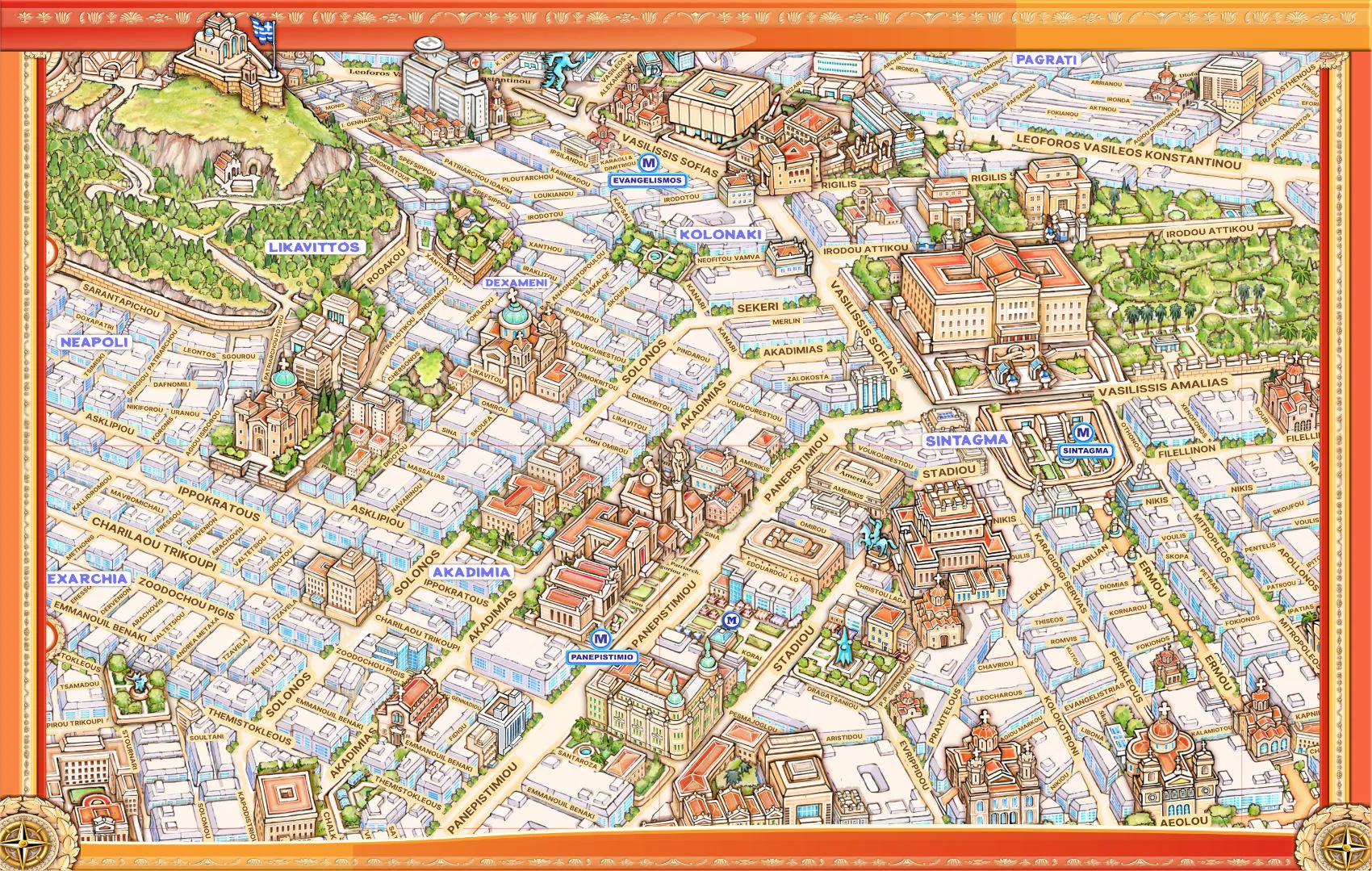
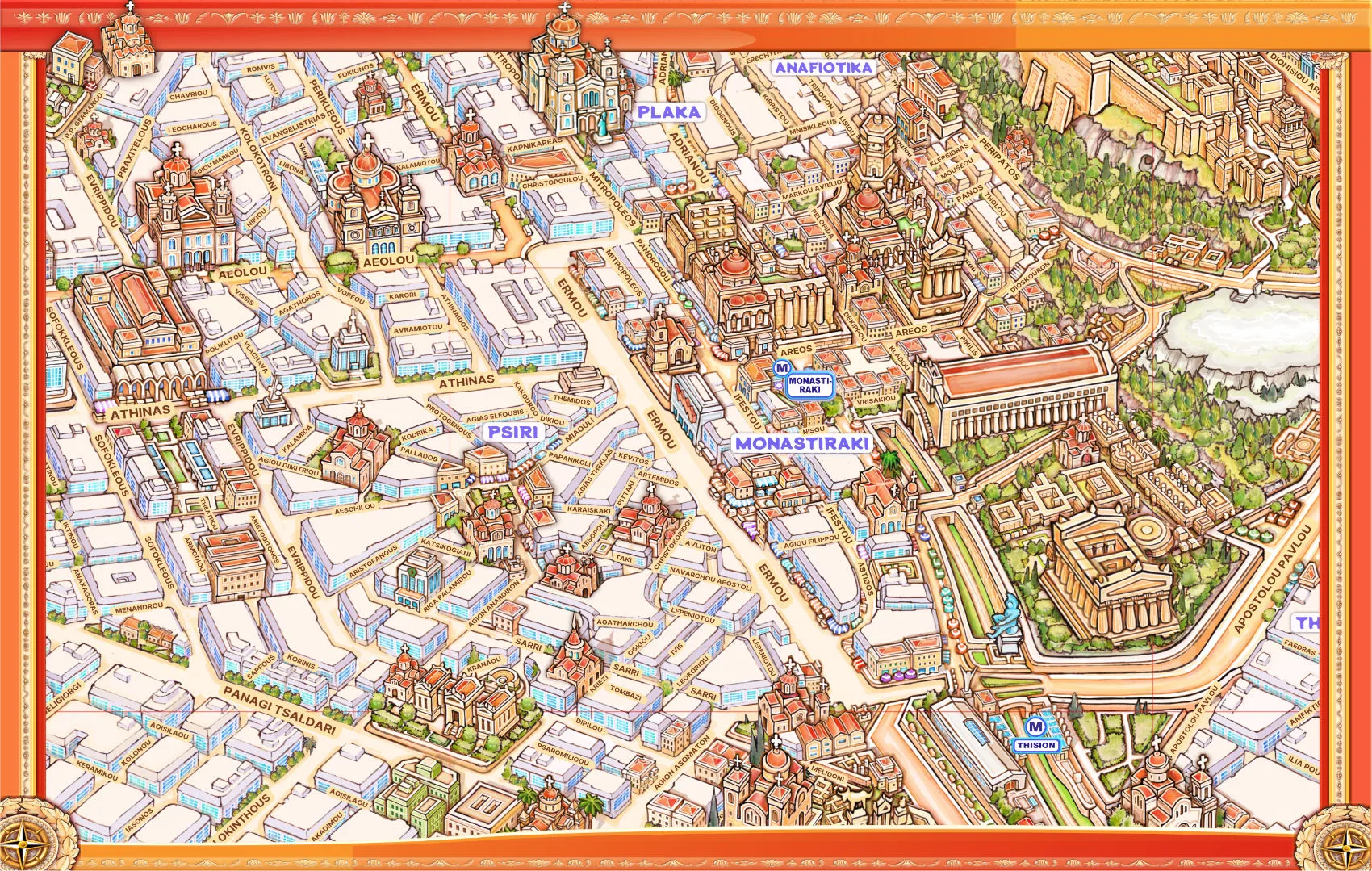
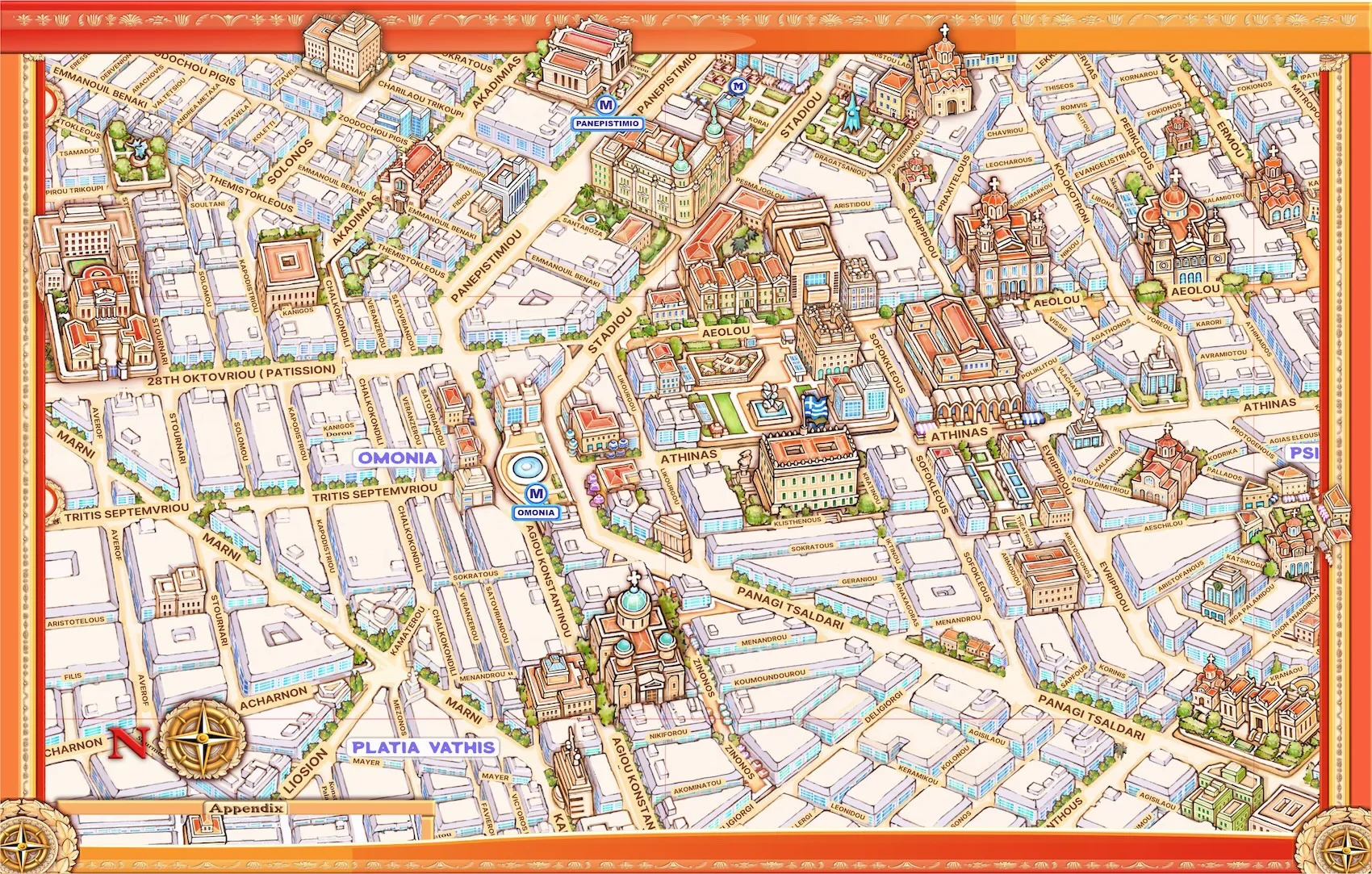

Modern Athens is a city where past and present exist side by side, offering a rich and immersive experience for visitors. From iconic landmarks such as the Acropolis, the Parthenon, and the Temple of Olympian Zeus to world-class museums and cultural institutions, the city reveals layers of history that have shaped Western civilisation. Using the illustrated Athens map, visitors can easily navigate these landmarks, understand their context, and discover how ancient heritage connects seamlessly with the modern city.
Beyond its historical depth, Athens unfolds as a vibrant and creative capital filled with street art, live performances, diverse cuisine, and lively neighbourhoods. The illustrated map becomes a companion for exploration, guiding visitors through cultural hotspots, local experiences, and hidden corners, from traditional flavours to contemporary urban life. Easy to use and visually engaging, it enhances every stage of the journey—before, during, and after the visit—transforming Athens into a city that is not only seen, but truly experienced.
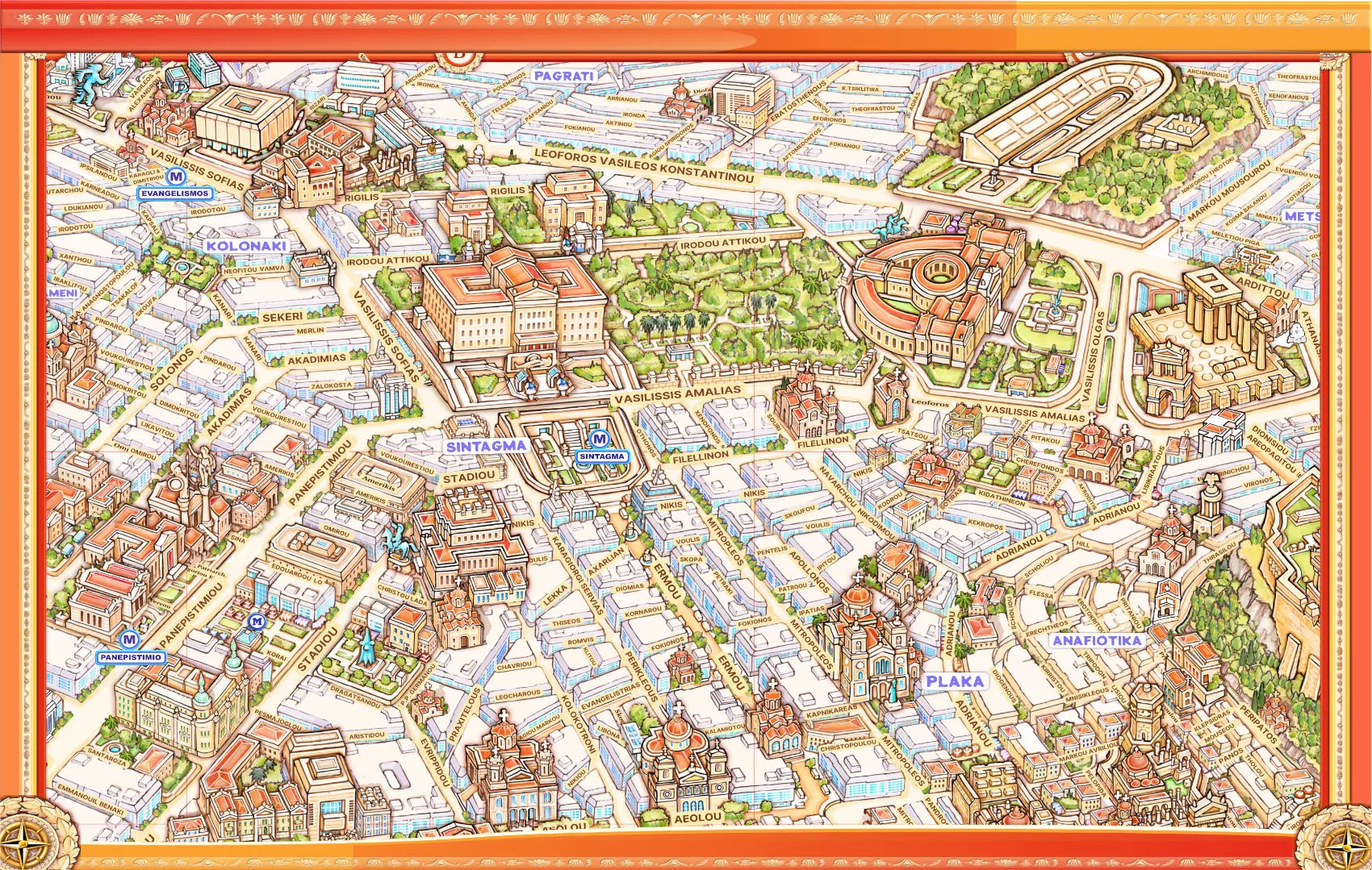
THE ILLUSTRATED MAP OF ATHENS
This Unique illustrated map of Athens historical city center was designed during 2020 mostly as a countermeasure for the stress of isolation that Covid-19 policies imposed on all of us. Traveling never stops, for the greatest traveler is the mind itself…This map is dedicated to all the people who never stopped to imagine the journeys of the times to come.
Our Athens illustrated map is the fruit of 12 months, or around 2500 hours of creative work.
VISUAL INFO
Depicts in a prospective way 9 square kilometres (3x3) off the historical centre of Athens with a topographical accuracy off 99% ( or 1% loss).
It Visualise 201 interest points in their basic architectural form:
28 Ancient Monument Sites
25 Museums
52 Recent time Monuments and Public Buildings
47 Churches
48 Squares
It includes full marcation for all 201 interest points mentioned on the map, plus an index for an easiest detection of each one of them.
It includes marcation for 461 streets on the map, (plus a street index in the back page of the folded edition).