


Athens Map
- Offset print, Size 70x100cm.
- Full Colour with protective water based varnish.
- Printed both sides.
- Paper weight 115 grams.
- Items weight 76 grams.
€10,00 Including Tax 19% €11,90

Step into the enchanting world of Athens, Greece, with our meticulously detailed Illustrated Athens Map Travel Guide. More than a mere map, this comprehensive guide is your key to unlocking the secrets of the capital city, Athens, and its surrounding urban areas.
Spanning 9 square kilometers (3x3), the map boasts an impressive topographical accuracy of 98%, providing an immersive experience of the Athens Urban Area. From North Athens to South Athens, and Central Athens to the iconic Athens Center Square, each section of the city is thoughtfully depicted, offering a rich tapestry of history, culture, and architecture.
As you explore the city, be captivated by the provisional capital's unique charm, where every street and square tells a story of a city that has been at the forefront of Western civilization for centuries. The Athens Ring guides you through the city's landscape, connecting you to its beating heart and offering a glimpse into the diverse districts that contribute to Athens' dynamic identity.
Delve into the historical center, marked by the Athens City Center, and witness the seamless blend of ancient and modern landmarks. The 28 Ancient Monument Sites unfold tales of the city's glorious past, while the 25 Museums provide a curated journey through artistic and historical treasures.
Contemporary Athens comes to life with depictions of 52 monuments and public buildings, showcasing the city's evolving identity. The 47 Churches, scattered across the Athens Urban Area, reflect the spiritual and architectural diversity that defines this vibrant metropolis.
The Athens Center Square, a hub of activity and culture, invites you to experience the lively pulse of the city. Explore iconic locations like Pedion Areos and Lofos Filopappou, where history and modernity coalesce, creating a unique atmosphere found only in Athens, Greece.
This Illustrated Map and Athens Travel Guide not only navigate you through the streets and landmarks but also serve as a visual testament to the provisional capital's significance. Whether you're a history enthusiast, an architecture aficionado, or a traveler seeking to uncover the secrets of Athens, this guide is your passport to an enriching and immersive experience in the heart of this ancient city.
Travel Guide. More than a mere map, this comprehensive guide is your key to unlocking the secrets of the capital city, Athens, and its surrounding urban areas.
Spanning 9 square kilometers (3x3), the map boasts an impressive topographical accuracy of 98%, providing an immersive experience of the Athens Urban Area. From North Athens to South Athens, and Central Athens to the iconic Athens Center Square, each section of the city is thoughtfully depicted, offering a rich tapestry of history, culture, and architecture.
As you explore the city, be captivated by the provisional capital's unique charm, where every street and square tells a story of a city that has been at the forefront of Western civilization for centuries. The Athens Ring guides you through the city's landscape, connecting you to its beating heart and offering a glimpse into the diverse districts that contribute to Athens' dynamic identity.
Delve into the historical center, marked by the Athens City Center, and witness the seamless blend of ancient and modern landmarks. The 28 Ancient Monument Sites unfold tales of the city's glorious past, while the 25 Museums provide a curated journey through artistic and historical treasures.
Contemporary Athens comes to life with depictions of 52 monuments and public buildings, showcasing the city's evolving identity. The 47 Churches, scattered across the Athens Urban Area, reflect the spiritual and architectural diversity that defines this vibrant metropolis.
The Athens Center Square, a hub of activity and culture, invites you to experience the lively pulse of the city. Explore iconic locations like Pedion Areos and Lofos Filopappou, where history and modernity coalesce, creating a unique atmosphere found only in Athens, Greece.
This Illustrated Map and Athens Travel Guide not only navigate you through the streets and landmarks but also serve as a visual testament to the provisional capital's significance. Whether you're a history enthusiast, an architecture aficionado, or a traveler seeking to uncover the secrets of Athens, this guide is your passport to an enriching and immersive experience in the heart of this ancient city.
Related products
-
Sale!
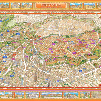
Illustrated Panoramic Nicosia Map - BOX 50pcs
Original price was: €500,00.€200,00Current price is: €200,00. Including Tax 19% €238,00 Add to cart -
Sale!
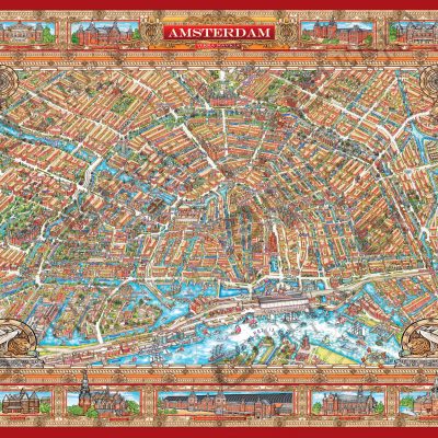
Illustrated Panoramic Amsterdam Map - BOX 50pcs
Original price was: €500,00.€200,00Current price is: €200,00. Including Tax 19% €238,00 Add to cart -
Nicosia Map
€10,00 Including Tax 19% €11,90 Add to cart -
Sale!
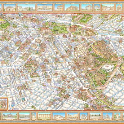
Illustrated Panoramic Athens Map - BOX 50 pcs
Original price was: €500,00.€200,00Current price is: €200,00. Including Tax 19% €238,00 Add to cart

